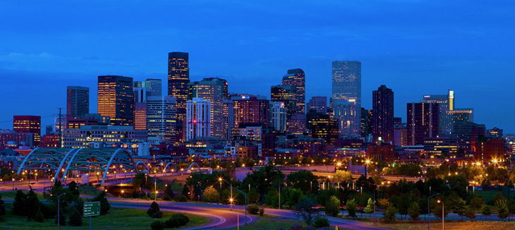
Denver, the capital of Colorado, is an American metropolis dating to the Old West era. Larimer Square, the city’s oldest block, still features landmark 19th-century buildings. Museums include the Denver Art Museum, an ultramodern complex known for its indigenous works collection, and the mansion of famed Titanic survivor Molly Brown. Denver is also a jumping-off point for skiing in the nearby Rocky Mountains.
Population: 649,495 (2013) | Area codes: Area codes 303 and 720
State in the west-central United States in the Rocky Mountains, bordered by Wyoming and Nebraska to the north, Nebraska and Kansas to the east, Oklahoma and New Mexico to the south, and Utah to the west. Its capital and largest city is Denver. The name comes from Spanish for the color red, signifying the Colorado river. It was admitted as the 38th state in 1876. First explored by the Spanish in the 16th and 17th centuries, the region was added to the United States through the Louisiana Purchase (1803) and a cession by Mexico (1848). The Colorado Territory was organized in 1861.
Area, 104,247 sq mi (270,000 sq km). Highest pt., Mt. Elbert, 14,433 ft (4,402 m); lowest pt., Arkansas River, 3,350 ft (1,022 m).

Abbreviation: CO
Capital City: Denver
Date of Statehood: Aug. 1, 1876
State #: 38
Population: 4,301,261
Area: 104100 sq.mi. Land 103730 sq. mi. Water 371 sq.mi.
State Bird: Lark Bunting
State Flower: Rocky Mountain Columbine
State Motto: Nil sine Numine — Nothing without Providence
State Nickname: Centennial State / Colorful Colorado
State Song: Where the Columbines Grow
About the Flag
Adopted in 1911, Colorado’s flag consists of three alternate stripes of equal width and at right angles to the staff, the two outer stripes being blue and the middle stripe white. A circular red C graces the flag, with a golden disk completely filling the open space inside the letter. Attached to the flag is a cord of gold and silver, intertwined, with tassels, one of gold and one of silver.

Geography
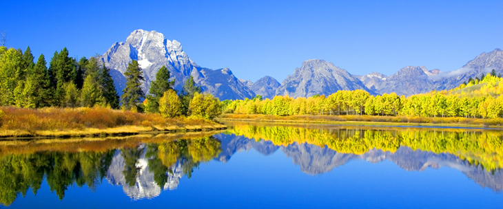
Colorado’s eastern expanses are part of the High Plains section of the Great Plains. On their western edge the plains give way to the Rocky Mountains, which run north-south through central Colorado. The mountains are divided into several ranges that make up two generally parallel belts, with the Front Range and a portion of the Sangre de Cristo Mts. on the east and the Park Range, Sawatch Mts., and San Juan Mts. on the west. Mt. Elbert (14,433 ft/4,399 m) is the highest peak in the U.S. Rocky Mts. The mountain ranges are separated by high valleys and basins called parks. These include North Park, Middle Park, South Park, Estes Park, and San Luis Park. The Continental Divide runs north-south along the Rocky Mts. in Colorado.

One of the most scenic states in the country, Colorado has recreational parks including Rocky Mountain National Park, Black Canyon of the Gunnison National Park with its narrow gorge cut by the Gunnison River, Dinosaur National Monument in NW Colorado, and Great Sand Dunes National Monument and Preserve in S central Colorado. Mesa Verde National Park and Canyons of the Ancients National Monument, once home to the Anasazi cliff dwellers, are in the southwestern corner of the state, a beautiful but formidable area of mesas and canyons.
Most of W Colorado is occupied by the Colorado Plateau, where deep canyons have been formed by the action of the Colorado, Gunnison, and other rivers. Colorado has a mean elevation of c.6,800 ft (2,070 m) and has 51 of the 80 peaks in North America over 14,000 ft (4,267 m) high, thus laying claim to the name “top of the world.”
A broad timber belt, largely coniferous and mostly within national forest reserves, covers large sections of the mountains. The mighty Colorado River originates in Rocky Mountain National Park, and the headwaters of the North Platte, South Platte, Arkansas, and Rio Grande also gather in Colorado’s mountains. The average annual rainfall in Colorado is only 16.6 in. (42.2 cm), but the state has been able to develop otherwise unusable land and ranks high among the states in irrigated acres. The Colorado–Big Thompson project and the Fryingpan-Arkansas project are two major water-diversion systems that carry water by tunnel across the Continental Divide to farms on the plains of E Colorado.
Most of the population lives in cities among the Front Range foothills, principally in Denver, the capital, largest city, and regional metropolis. Other major cities are Colorado Springs, Aurora, Lakewood, and Pueblo.
U.S. Quarter for Colorado

