
Arizona
A state of the southwest United States on the Mexican border. It was admitted as the 48th state in 1912. Explored by the Spanish beginning in 1539, the area was acquired by the United States in 1848 through the Treaty of Guadalupe Hidalgo. Phoenix is the capital and the largest city. The state is bordered by Utah (N), New Mexico (E), Mexico (S), and, across the Colorado R., Nevada and California (W). The name comes from a Spanish interpretation of “arizuma,” an Aztec Indian word meaning “silver-bearing;” and Pima Indian word “arizonac” for “little spring place”
Abbreviation: AZ
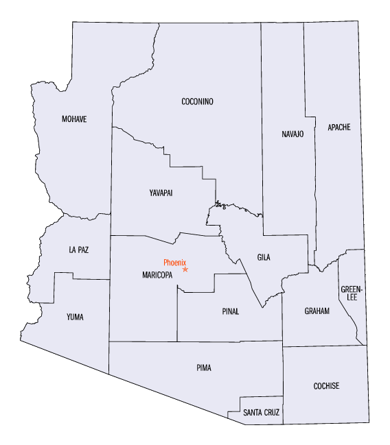
Capital City: Phoenix
Date of Statehood: Feb. 14, 1912
State #: 48
Population: 5,130,632
Area: 114006 sq.mi. Land 113642 sq. mi. Water 364 sq.mi.
State Bird: Cactus Wren
State Flower: Saguaro Blossom
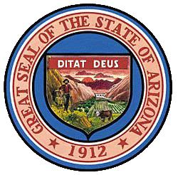
State Motto: Ditat Deus — God enriches
State Nickname: The Grand Canyon State
State Song: Arizona
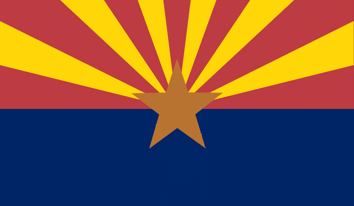
About the Flag
Adopted in 1917, the 13 rays of red and gold on the top half of the flag represent both the 13 original colonies of the Union, and the rays of the Western setting sun. The bottom half of the flag has the same Liberty blue as the United States flag. Since Arizona was the largest producer of copper in the nation, a copper star was placed in the flag’s center.
Geography
Northern Arizona lies on the Colorado Plateau, an area of dry plains more than 4,000 ft (1,220 m) high, with deep canyons, including the famous Grand Canyon carved by the Colorado River. Along the Little Colorado River, which runs northwest through the plateau to join the Colorado, are the Painted Desert, where erosion has left colorful layers of sediment exposed, and the Petrified Forest National Park, one of the world’s most extensive areas of petrified wood. South of the Grand Canyon are the San Francisco Peaks, including Humphreys Peak, the highest point (12,655 ft/3,857 m) in the state. The southern edge of the Colorado Plateau is marked by an escarpment called Mogollon Rim.
The southern half of the state has desert basins broken up by mountains with rocky peaks and extending NW to SE across central Arizona. To the south, the Gila River, a major tributary of the Colorado, flows west across the entire state. This area has desert plains separated by mountain chains running north and south; in the west the plains fall to the relatively low altitude of c.140 ft (43 m) in the region around Yuma.
Although some mountain peaks receive an annual rainfall of more than 30 in. (76 cm), precipitation in most of the state is low, and much of Arizona’s history has been shaped by the inadequate water supply. Since the early 20th cent., massive irrigation projects have been built in Arizona’s valleys. Roosevelt, Horse Mesa, Mormon Flat, and Stewart Mountain dams, with reservoirs and storage lakes, irrigate the Salt River valley. The Gillespie Dam on the Gila River helps irrigate the Yuma vicinity. The Coolidge Dam, with its San Carlos reservoir, serves the area near Casa Grande in the southeast. W Arizona is irrigated by Colorado River dams, which also serve California. These include Hoover, Glen Canyon, Davis, Parker, Imperial, and Laguna dams. At the Parker dam, the Central Arizona Project diverts water via canal to Phoenix, the state’s capital and largest city, and Tucson, the second largest city. Arizona also obtains water from groundwater pumping stations.
History
Little is known of the earliest indigenous cultures in Arizona, but they probably lived in the region as early as 25,000 B.C. A later culture, the Hohokam (A.D. 500–1450), were pit dwellers who constructed extensive irrigation systems. The Pueblo flourished in Arizona between the 11th and 14th cent. and built many of the elaborate cliff dwellings that still stand. The Apache and Navajo came to the area in c.1300 from Canada.
Spanish Exploration and Mexican Control
Probably the first Spanish explorer to enter Arizona (c.1536) was Cabeza de Vaca. Franciscan friar Marcos de Niza reached the state in 1539; he was followed by Francisco Vásquez de Coronado, who led an expedition from Mexico in 1540 in search of the seven legendary cities of gold, reaching as far as the Grand Canyon. Despite extensive exploration, the region was neglected by the Spanish in favor of the more fruitful area of New Mexico. Father Eusebio Kino, a Jesuit, founded the missions of Guevavi (1692) and Tumacacori (1696), near Nogales, and San Xavier del Bac (1700), near Tucson. The Spanish Empire, however, expelled the Jesuits in 1767, and those in Arizona subsequently lost their control over the indigenous people.
The Arizona region came under Mexican control following the Mexican war of independence from Spain (1810–21). In the early 1800s, U.S. mountain men, trappers and traders such as Kit Carson, trapped beaver in the area, but otherwise there were few settlers.
U.S. Acquisition and the Discovery of Minerals
In the Treaty of Guadalupe Hidalgo (1848), ending the Mexican War (1846–48), Mexico relinquished control of the area N of the Gila River to the United States. This area became part of the U.S. Territory of New Mexico in 1850. The United States, wishing to build a railroad through the area S of the Gila River, bought the area between the river and the S boundary of Arizona from Mexico in the Gadsden Purchase (1853).
Arizona’s minerals, valued even by prehistoric miners, attracted most of the early explorers, and although the area remained a relatively obscure section of the Territory of New Mexico, mining continued sporadically. Small numbers of prospectors, crossing Arizona to join the California gold rush (1849), found gold, silver, and a neglected metal—copper.
In 1861, at the outbreak of the Civil War, conventions held at Tucson and Mesilla declared the area part of the Confederacy. In the only engagement fought in the Arizona area, a small group of Confederate pickets held off Union cavalry NW of Tucson in the skirmish known as the battle of Picacho Pass.
Territorial Status and Statehood
In 1863, Arizona was organized as a separate territory, with its first, temporary capital at Fort Whipple. Prescott became the capital in 1865. Charles D. Poston, who had worked to achieve Arizona’s new status, was elected as the territory’s first delegate to the U.S. Congress. The capital was moved to Tucson in 1867, back to Prescott in 1877, and finally to Phoenix in 1889.
The region had been held precariously by U.S. soldiers during the intermittent warfare (1861–86) with the Apaches, who were led by Cochise and later Geronimo. General George Crook waged a successful campaign against the Apaches in 1882–85, and in 1886 Geronimo finally surrendered to federal troops. When Confederate troops were routed and Union soldiers went east to fight in the Civil War, settlement was abandoned. It was resumed after the war and encouraged by the Homestead Act (1862), the Desert Land Act (1877), and the Carey Land Act (1894)—all of which turned land over to settlers and required them to develop it.
In the 1870s mining flourished, and by the following decade the Copper Queen Company at Bisbee was exploiting one of the area’s largest copper deposits. In 1877 silver was discovered at Tombstone, setting off a boom that drew throngs of prospectors to Arizona but lasted less than 10 years. Tombstone also became famous for its lawlessness; Wyatt Earp and his brothers gained their reputations during the famous gunfight (1881) at the O. K. Corral. By 1880 the Santa Fe and Southern Pacific railroads both extended into Arizona. Ranching began to thrive and sheep raising grew from solely a Navajo occupation to a major enterprise among white settlers. After 1897, the U.S. Forestry Bureau issued grazing permits to protect public land from depletion.
In 1912, Arizona, still a frontier territory, attained statehood. Its constitution created a storm, with such “radical” political features as initiative, referendum, and judicial recall. Only after recall had been deleted did President Taft sign the statehood bill. Once admitted to the Union, Arizona restored the recall provision.
|
|||||||||||||||||||||||||||||||||||||||||||||||||||||||||||||||||||||||||||||||||||||||||||||||||||||||||
|
|