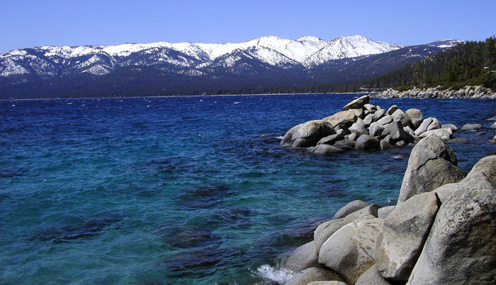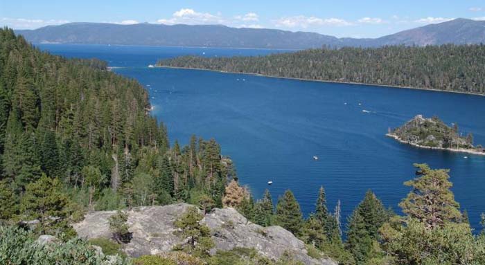
Nevada and California’s Lake Tahoe, 193 sq mi (500 sq km) freshwater lake in the Sierra Nevada, on the border between California and Nevada, near Carson City. Approximately two-thirds of the shoreline is in California. It occupies a basin in the Sierra Nevada and is drained by the Truckee River. its depth prevents it from freezing. Long known for its clearness, Lake Tahoe is a major vacation spot, with gambling resorts along the Nevada shoreline.
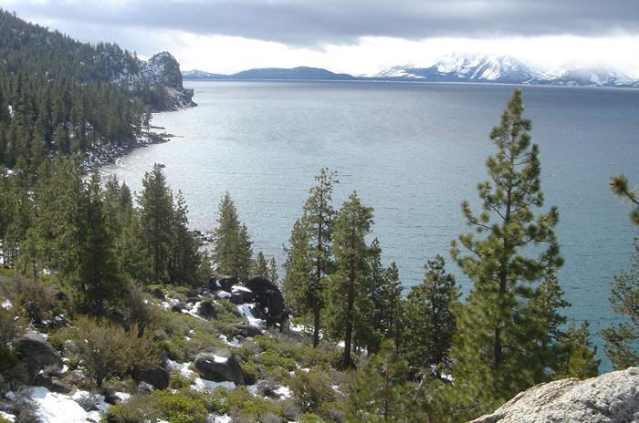
The Lake Tahoe Basin was formed by geologic block (normal) faulting about 2 to 3 million years ago. A geologic block fault is a fracture in the Earth’s crust causing blocks of land to move up or down. Uplifted blocks created the Carson Range on the east and the Sierra Nevada on the west. Down-dropped blocks created the Lake Tahoe Basin in between. Some of the highest peaks of the Lake Tahoe Basin that formed during this process were Freel Peak at 10,891 ft (3,320 m), Monument Peak at 10,067 ft (3,068 m) (the present Heavenly Valley Ski Area), Pyramid Peak at 9,983 ft (3,043 m) (in the Desolation Wilderness), and Mt. Tallac at 9,735 ft (2,967 m).
Snow, rain, and streams filled the southern and lowest part of the basin, forming the ancestral Lake Tahoe. Modern Lake Tahoe was shaped and landscaped by the scouring glaciers during the Ice Age (the Great Ice Age began a million or more years ago). Many streams flow into Lake Tahoe, but the lake is drained only by the Truckee River, which flows northeast through Reno and into Pyramid Lake in Nevada.
Lake Tahoe is the second deepest lake in the United States and the tenth deepest in the world, with a maximum depth measured at 1,645 ft (501 m), average depth of 1,000 ft (305 m). Crater Lake in Oregon is the deepest lake (1,949 ft or 594 m) in the United States. Please Note that the depth of Lake Tahoe changes every day as the lake level changes. The deepest measurement from the 1998 bathymetric survey was 1,637 ft (499 m) deep. The depth of Lake Tahoe depends on the height it is measured from; some measurements use sea level as a base reference, others use different points of reference. The appropriate reference, or datum, for Lake Tahoe’s depth is still being debated. Therefore the measured depth of a lake is only preliminary data and may change.
Lake Tahoe is about 22 mi (35 km) long and l2 mi (19 km) wide and has 72 mi (116 km) of shoreline and a surface area of 191 mi2 (495 km2). The floor of the Lake Tahoe Basin is at an elevation of about 4,580 ft (1,396 m), which is lower than the surface of the Carson Valley to the east! With an average surface elevation of 6,225 ft (1,897 m) above sea level, Lake Tahoe is the highest lake of its size in the United States.
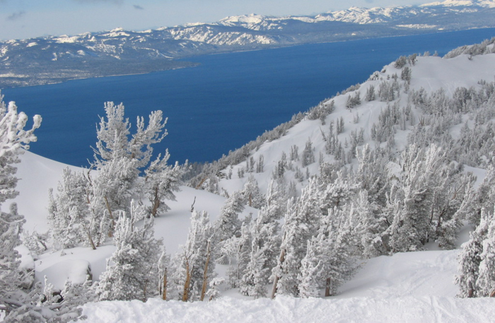
The water temperature near the surface generally cools to 40 to 50oF (4.5 to 10oC) during February and March and warms to 65 to 70oF (18 to 21oC) during August and September. Below a depth of 600 to 700 ft (183 to 213 m), the water temperature remains a constant 39oF (4.0oC).
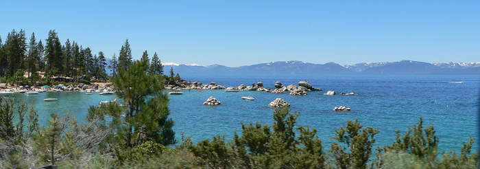
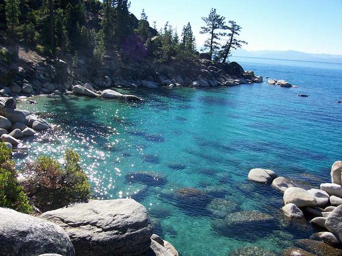
Lake Tahoe has a water clarity of about 100 ft (30 m) deep. Factors contributing to its clarity include the following:
40 percent of the precipitation that falls into the Lake Tahoe Basin lands directly on the lake.
Remaining precipitation drains through granitic soils, which are relatively sterile and create a good filtering system.
Lake Tahoe is one of the deepest (1645 feet/501 m), largest (192 sq. mi./497 km²) and highest (6229 feet/1898 m. above sea level) lakes in the United States. Only Oregon’s Crater Lake is deeper at 1930 feet (588 m).
Although for much of Tahoe’s circumference, highways run within sight of the lake shore, some important parts of the California shoreline now lie within state parks or are protected by the United States Forest Service. Nevada seems to have been less active, or less successful, in its conservation efforts. Lake Tahoe is about 22 mi (35 km) long and 12 mi (19 km) wide and has 72 mi (116 km) of shoreline and a surface area of 191 square miles or 495 square kilometers.
The Lake Tahoe Basin was formed by geologic block (normal) faulting about 2 to 3 million years ago. A geologic block fault is a fracture in the Earth’s crust causing blocks of land to move up or down. Uplifted blocks created the Carson Range on the east and the Sierra Nevada on the west. Down-dropped blocks created the Lake Tahoe Basin in between. Some of the highest peaks of the Lake Tahoe Basin that formed during this process were Freel Peak at 10,891 ft (3,320 m), Monument Peak at 10,067 ft (3,068 m) (the present Heavenly Valley Ski Area), Pyramid Peak at 9,983 ft (3,043 m) (in the Desolation Wilderness), and Mount Tallac at 9,735 ft (2,967 m).
Snowmelt filled the southern and lowest part of the basin, forming the ancestral Lake Tahoe, with rain and runoff adding additional water. Modern Lake Tahoe was shaped and landscaped by the scouring glaciers during the Ice Age (the Great Ice Age began a million or more years ago). Many streams flow into Lake Tahoe, but the lake is drained only by the Truckee River, which flows northeast through Reno and into Pyramid Lake in Nevada.
The south shore is dominated by the lake’s largest city, South Lake Tahoe, California, which neighbors Stateline, Nevada. Tahoe City, California is located on the lake’s northwest shore.
The lake’s position is 39°N, 120°W.